THANK YOU FOR SUBSCRIBING
Top Benefits of The Drones for Businesses
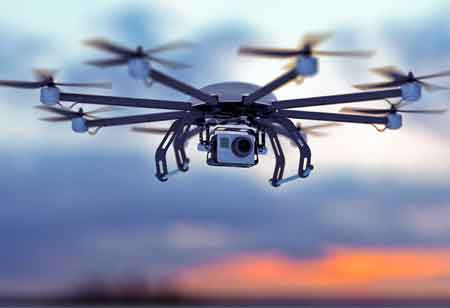
Drones have previously been beneficial to capture aerial footage for film and television, as well as to check hard-to-reach places for utility and energy businesses
By
Apac CIOOutlook | Monday, October 04, 2021
Stay ahead of the industry with exclusive feature stories on the top companies, expert insights and the latest news delivered straight to your inbox. Subscribe today.
The global market for drone technology gets anticipated to quadruple by 2024, with a value of about 14 billion dollars.
Fremont, CA: Drones have previously been beneficial to capture aerial footage for film and television, as well as to check hard-to-reach places for utility and energy businesses, such as power lines, pipelines, and transmission infrastructure. Ranchers and rural veterinarians also use drones to monitor animals. In addition, they are helpful by engineering and construction businesses to monitor progress and compliance on construction sites. But that's only the start.
The global market for drone technology gets anticipated to quadruple by 2024, with a value of about 14 billion dollars. Yet, despite all of this enthusiasm, drones remain a niche technology for enterprises. However, drones, with the right supporting technology and applications, may provide strategic and competitive benefits and increased efficiency.
- Special Delivery: Drones Make Services and Deliveries More Accessible
Amazon obtained government clearance to begin flying its Prime Air delivery drone fleet in the summer of 2019. Consumer items aren't the only things that drones may deliver. Drones have been helpful as roaming cellular towers by wireless providers to offer coverage in distant regions. Google and Facebook are investigating ways to utilize drones to provide Wi-Fi.
Both projects have a desire to enhance efficiency, either by avoiding traditional sorting and distribution networks or by lowering the cost of delivering signals to remote locations. In addition, it establishes a direct business-to-consumer line when none previously existed.
- Location Siting: Drones and Maps Capture Space and Time
A vast new air freight complex featuring a hub for Amazon Air's fleet of delivery planes is getting built at San Bernardino International Airport in Southern California. Drones hover overhead taking precise pictures as the site advances, their flight patterns defined by specifying the paths on a GIS-enabled tablet.
This picture is essential in and of itself as a fast way for stakeholders to assess the development of a project. It can, however, be combined with a digital terrain model that monitors the volume of earth taken from the building site. In addition, with recent improvements in photogrammetry, data gathered from angles may be converted into point clouds and photo-realistic models, allowing for 2D, 3D, and volumetric measurements.
- See Beyond: Imagery Analysis and Data Science across Industries
As part of a “smart cities” plan, local administrations are increasingly employing comprehensive modeling of jurisdictions. For example, drone pictures may get used to creating complex 3D cityscapes. In addition, the data may be synced and compared over the years to see the impact of developments and visualize the influence of future initiatives.
Power and utility firms continue to employ drones to examine pipelines, powerlines, and other infrastructure, taking advantage of the simplicity of picture capturing provided by drones. However, the most forward-thinking companies are already utilizing AI and GIS to analyze drone photos and identify areas that require maintenance. Repair workers are then only deployed to the places that need care.