THANK YOU FOR SUBSCRIBING
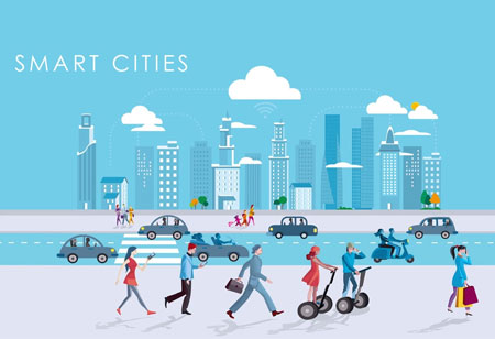
Streamlining Smart Cities with GIS
Geographic Information System (GIS) in a smart city environment can serve a spectrum of services ranging from energy-efficient housing initiative to smart e-services for sustainable urban management
By
Apac CIOOutlook | Thursday, January 01, 1970
Stay ahead of the industry with exclusive feature stories on the top companies, expert insights and the latest news delivered straight to your inbox. Subscribe today.
Decades of unplanned urbanization has induced rampant pollution, sanitation hazards, inadequate housing, slums, and transport perils, Along with that, extreme weather patterns have become a global concern. It is about time data-driven adaptive urbanism—smart cities—gains momentum, building cities as models of a global change.
This model will pave the way for connected spatial data flow, enabling every resident in the city to comprehend the goals the community needs to accomplish. The residents can utilize applications to keep themselves informed about recreation, business, property, transportation, taxation, and more.
These smart cities function round-the-clock in a cloud environment and are entirely based on knowledge and innovation for best and sustainable civilian services. The definitions for smart cities vary depending on geographies, deployment, and scaling. However, in a data-driven environment aimed at efficiency, transparency and sustainability must be served by an intelligent community framework.
In order to do that, a community must upgrade the following processes: activating and connecting sensor networks, facilitating cross-organizational collaboration, and organizing and geo-enabling data. This is where Geographic Information System (GIS) comes into play. Integrating GIS in a smart city environment can serve a spectrum of services ranging from energy-efficient housing initiative to smart e-services for sustainable urban management, planning, and development.
The integrated cross-sectoral platform—or smart city GIS framework—collects, manages, compiles, analyzes, and visualizes spatiotemporal information for a seamless flow of information throughout the smart city via the cloud.
Conveying all that complex information seamlessly through the cloud is hard, but making sense of city data is even more so. Smart cities can make use of data-driven maps and animated graphics with the help of an interactive dashboard, to help people get a good understanding of the city data. Mapped reports make it easier to highlight a problem, fasten response, and direct the solutions accordingly, providing the public with accurate insights into the already built city environment.
Smart capabilities and quick response intersect in the vicinity of predictive data analytics. The mapped information can be leveraged to understand how the future will unfold, giving way for a more informed response. Activating Internet of Things (IoT)-enabled sensor networks and forecasting capabilities give smart cities a significant edge in averting any possible disaster. But in order to achieve that, the government and civic department must collaborate with each other.
With real-time location-based tools, GIS assists in open sharing and updating of information within the smart city framework, bringing a whole new level of engagement that is connected, accessible, and easy-to-understand.
See Also: Top GIS Solution Companies